What's New

What's New or Updated

Updated Ready-to-Print PDF Maps for Knoxville and Knox County

New look and added features!

 KGIS has updated all of the Printable PDF Maps on its website.  These new maps are simplified and easy to read.  They also contain clickable links to KGIS, Knoxville, Knox County, Knox County Schools, Farragut, and TN State Government websites.  For a more detailed view of a particular area on any given map, just click on the link to KGIS Maps below the map title!  Locate these free maps on the KGIS website by selecting Products>Hard Copy Maps>Ready Made PDF Maps, or Click HerePlease enjoy, and keep an eye out for new maps in the near future!
Friday, July 31, 2015/Author: Will Fontanez/Number of views (6130)/Comments (0)/ Article rating: 4.7
Categories: Public

FEMA Flood Maps have been updated with modified symbology and labels

MPC has recommended some changes to the FEMA Flood zones map on the KGIS viewers. Many people, even city and county staff cannot readily interpret what they see when they turn on the FEMA layers. To view the FEMA Flood Maps on KGIS Maps click here.

Tuesday, June 2, 2015/Author: Jimmy Brink/Number of views (1746)/Comments (0)/ Article rating: 3.7
Categories: Public

KGIS Maps link to Google Street View now more powerful

Google Trekker data for Trails / Greenways made available

Google continues to add new tools and data content, and its latest incorporation of virtual tours of Knoxville and Knox County trails and greenways is just the latest. Users of KGIS Maps can also take advantage of that new information by using the Google Street Map integration tool. Click Here for More...

Thursday, April 23, 2015/Author: Keith G. Stump/Number of views (20672)/Comments (0)/ Article rating: 3.0
Categories: Public

Old Architecture Easy to Find with KGIS Maps

National Register Historic Buildings

From the Boyd Harvey House nestled deep in the southwest corner of the county to the Arnweyn House that stands a stone’s throw from the Holston River, Knox County is home to many antebellum structures, sites, and districts listed on the National Register of Historic Places. A new theme in the KGIS Maps website—powered by data compiled by MPC staff—makes finding those historic places as easy as clicking a mouse. MORE..
Wednesday, March 4, 2015/Author: Jimmy Brink/Number of views (4278)/Comments (0)/ Article rating: 5.0
Categories: Public

FEMA data now updated on KGIS Maps

National Flood Hazard Layer (NFHL)
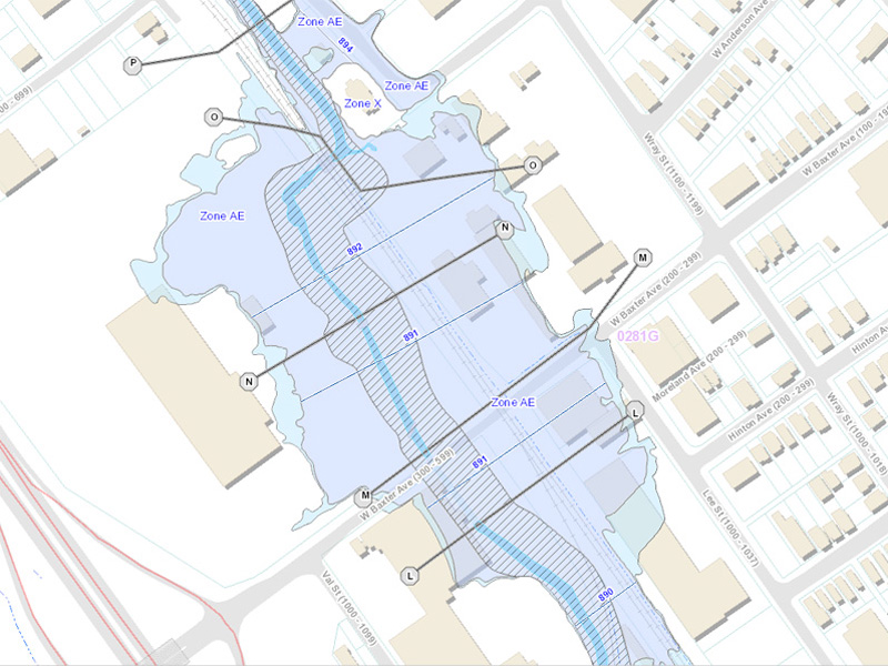
The National Flood Hazard Layer (NFHL) dataset represents the current effective flood data for Knox County.  This dataset is a compilation of effective Flood Insurance Rate Map (FIRM) databases and Letters of Map Change (LOMCs). KGIS received the data in December 2013, but upon the initial review of the dataset it had large amounts of missing data. After several months of revisions by FEMA, KGIS finally received a finished dataset. Although several database table/layer changes have occurred since the last update in 2007, we have been able to display the data using the same symbology KGIS has used for the last couple of years. Please go to KGIS Maps-->Maps--> Planning and Zoning Maps--> and Click on FEMA Flood Map or click here. READ MORE

Tuesday, May 13, 2014/Author: Chris Halcomb/Number of views (9498)/Comments (0)/ Article rating: 4.0
Categories: Public
12345678