Interactive graphs, maps and charts
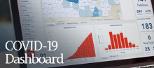 The State of Tennessee's COVID-19 Unified Command has produced a GIS-based COVID-19 Dashboard that provides interactive access to statewide maps, data, graphs and charts related to the ongoing emergency. Different panels on the dashboard provide information related to the distribution of cases by county (and age), along with the geographical locations of Assessment (or testing) Sites across the state (including Knoxville and Knox County). Links to this and other COVID-related maps, including additional testing sites, can be found on KGIS's COVID-19 Maps & GIS page.