KGIS Maps has been updated with a new set of 2019 Aerial orthophotography from the Tennessee Department of Transportation (TDOT), which has a regular aerial update program that involves flying each region (of which there are four total) of the state at least once over a four (4) year period. Prior to this 2019 mission, TDOT most recently flew East Tennessee back in 2015.
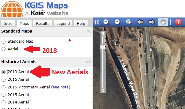
Since the resolution (of 1 foot) of the 2019 orthophotography is not quite as detailed as KGIS's standard 6" digital orthophoto aerials, KGIS has decided to NOT replace the default Aerial map with this newly updated 2019 aerial. (Note: The default Aerial map represents spring 2018 and was acquired at a 6" resolution). KGIS Maps users will instead access the 2019 aerials in the "Maps....Historical Aerials" section of KGIS Maps. (see image below). The 2019 aerial currently accessible in KGIS Maps covers only Knox County.
It should also be noted that KGIS expects to receive in May/June 2020 timeframe a new set of 6" resolution aerials covering all of Knox County and the extended KUB service area. Once that data has been finalized, the default Aerial theme of KGIS Maps will be updated.