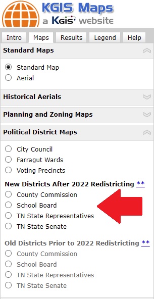
New "2022" boundaries are now the DEFAULT map on KGIS
The Tennessee State House and Senate district boundaries have been updated on the KGIS system to reflect the newly adopted "2022" boundaries as approved and signed into law in February of 2022.
 Every 10 years, the US Census Bureau conducts extensive population counts to ensure equal representation by government. If the updated population tallies reveal that some districts have significantly more or fewer people than the others, the district boundaries must be adjusted to rebalance the population.
The various maps and reports on the KGIS website have all now been updated to display these newly adopted "2022" boundaries. Any questions regarding one's state House or Senate representative should be directed to the State Comptroller's Office. (Click here to access the State's Re-districting dashboard).
The new "2022" boundaries that display on the KGIS system are, to the best of our knowledge, the certified boundaries as provided to KGIS by the Knoxville-Knox County Planning department. It is KGIS's understanding that these new "2022" boundaries were based upon the US Census data, and are therefore dependent upon the accuracy and precision of those source map datasets. Users of the KGIS system should note that the boundaries do not always align with KGIS's basemap features, especially at the "zoomed in" levels.
The following applications have all been updated to display/report using the new "2022" Districts:
- Voting Location Search
- Parcel Map & Details Map
- KGIS Maps: TN State Representative; TN State Senate Map themes
- KGIS Maps: Parcel Identify...Get Full Parcel Details....Voting Information tab.
- The Ready Made Maps:TN State House and TN State Senate maps
For information on voting locations contact the Knox County Election Commission. (website).