KGIS News

KGIS News

2024 Aerials Now Available

Preliminary aerials for 2024 added to KGIS Maps

A new set of "preliminary" aerials from Winter 2024 have been added to KGIS Maps These aerials are a by-product of the oblique photography capture conducted by  EagleView\Pictometry (on behalf of the Knox County Property Assessor's office and KGIS). The more accurate version of these aerials will be made available later this year.

These 2024 aerials can be toggled on by selecting "2024 Aerial Preliminary" theme in the  "Historical Aerials" section of the Maps panel. ( The default "Aerial" map theme of KGIS Maps still reflects the 2022 vintage aerials.)

While the 2024 aerial image is an accurate representation of ground conditions (at the time taken), it has not been fully rectified and should ONLY be used with the following understanding:

  • The imagery has NOT been fully rectified to ground control and is not as accurate as a true orthophoto.
  • The imagery may have breaks, gaps, and other issues. This is especially true around elevated features such as bridges and overpasses.

2024 Aerial Oblique images are also available. Access them via the Launch...Pictometry tool in the blue command strip at the top of the KGIS Maps page.

Tuesday, April 9, 2024/Author: Bryan Lynn/Number of views (125)/Comments (0)/ Article rating: No rating
Categories: Public

2022 Aerials Now Available

Preliminary aerials for 2022 added to KGIS Maps

A new set of "preliminary" aerials from Spring 2022 have been added to KGIS Maps These aerials are a by-product of the oblique photography capture conducted by  EagleView\Pictometry (on behalf of the Knox County Property Assessor's office and KGIS). The more accurate version of these aerials will be made available later this year.

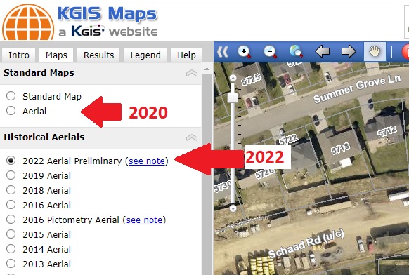
These 2022 aerials can be toggled on by selecting "2022 Aerial Preliminary" theme in the  "Historical Aerials" section of the Maps panel. ( The default "Aerial" map theme of KGIS Maps still reflects the 2020 vintage aerials.)

While the 2022 aerial image is an accurate representation of ground conditions (at the time taken), it has not been fully rectified and should ONLY be used with the following understanding:

  • The imagery has NOT been fully rectified to ground control and is not as accurate as a true orthophoto.
  • The imagery may have breaks, gaps, and other issues. This is especially true around elevated features such as bridges and overpasses.
  • Due to weather and ground conditions, the full project was acquired over a 2-3 month time period. Therefore, one will notice that some areas have more vegetatin than others.

2022 Aerial Oblique images are also available. Access them via the Launch...Pictometry tool in the blue command strip at the top of the KGIS Maps page.

Friday, July 8, 2022/Author: Keith G. Stump/Number of views (3444)/Comments (0)/ Article rating: 2.8
Categories: Public

Preliminary 2016 Aerial Theme added to KGIS Maps

Located under the Historical Aerials group

A new 2016 Aerial (Preliminary) map theme has been added to KGIS Maps. Since these aerials are preliminary, by-products of the Spring 2016 Knox County Property Assessor project with EagleView - Pictometry , they don't quite meet the product standards of past KGIS aerial products. Therefore, instead of replacing the default Aerial Theme (which is still vintage 2014), the preliminary aerials are located under the Historical Aerials category of Map themes (see image). READ MORE....

Thursday, May 26, 2016/Author: Keith G. Stump/Number of views (1834)/Comments (0)/ Article rating: 5.0
Categories: Public

2016 Aerial Images now visible via KGIS Maps

Updated 360° Oblique Photos from Pictometry

Newly acquired Spring 2016 oblique, 360° aerial imagery is now accessible to the KGIS Maps audience. Acquired in the Spring of 2016 by the Knox County Property Assessor,  the EagleView - Pictometry imagery provides a fresh, updated look at our ever-changing Knoxville and Knox County landscape. (For example, Click here to compare the 2016 and 2014 images of the redesigned Fort Dickerson Park entrance.). To access the....READ MORE

Thursday, April 21, 2016/Author: Keith G. Stump/Number of views (4517)/Comments (0)/ Article rating: 5.0
Categories: Public

Tips & Tricks: Oblique Imagery via KGIS Maps

How to Access Oblique Imagery

KGIS Maps Tip & Tricks: To access the oblique aerial imagery from KGIS Maps, one will want to use the Launch drop-down tool located on the blue toolbar  near the top of the screen. Click here for more information...

.

Monday, November 9, 2015/Author: Keith G. Stump/Number of views (2481)/Comments (0)/ Article rating: 3.5
Categories: Public